Wildland–Urban Interface (WUI) Fire Risk Research
Revealing the Global Expansion of the Wildland–Urban Interface (WUI) and WUI Fires with Machine Learning
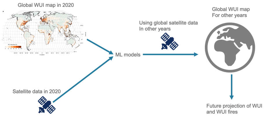
To understand how the boundaries between developed land and natural areas are changing around the world, we built a new global map of wildland–urban interface (WUI) areas - the places where homes and buildings sit next to forests, grasslands, or other natural vegetation where wildfires can occur. By training machine-learning models on satellite data from 2001–2020, we created a 9-kilometer resolution Worldwide Unified Wildland–Urban Interface (WUWUI) database.
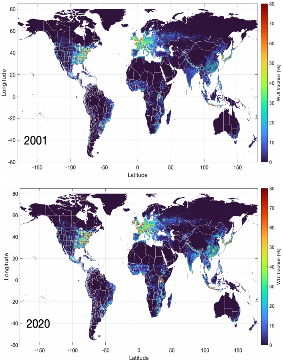
Figure: WUI fraction in % for 2001 (top panel) and 2020 (bottom panel).
These maps show that WUI areas increased across all populated continents from 2001 to 2020. Over the same period, global total fire counts decreased by 10% from 2005 to 2020, while the fraction of fires occurring in WUI increased by 23%. In other words, even though there were slightly fewer fires overall, more of them occurred close to where people live. Understanding where these high-risk areas are expanding helps communities, planners, and policymakers better prepare for wildfire exposure and long-term land-use change for fire-management strategies. The WUWUI dataset is publicly available for researchers and the community. Learn more.
Contact: Wenfu Tang.